Tropical trouble is once again developing in the Atlantic, as a new system could target the U.S. Southeast by early next week, joining Hurricane Humberto by Saturday. Unlike Humberto, though, this storm may strike directly, offering little time for preparation.
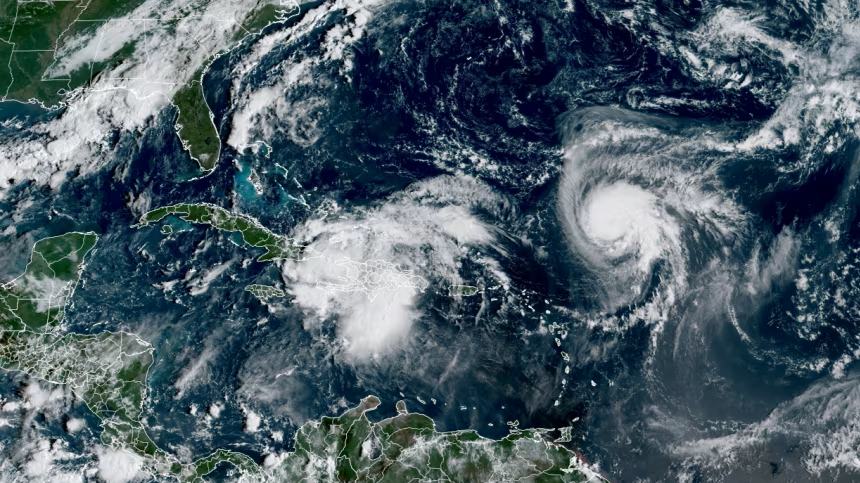
Late Friday, a cluster of rain and thunderstorms near the southeastern Bahamas was labeled Potential Tropical Cyclone Nine by the National Hurricane Center. This designation is used for disturbances that haven’t fully developed but are expected to bring tropical storm conditions to land within 72 hours.
As a result, a tropical storm warning has been issued for the central Bahamas, while a watch is in place for the northwestern islands.
Forecasters expect the system to become a tropical depression by Saturday and potentially strengthen into Tropical Storm Imelda by Saturday night. It could intensify further, possibly reaching Category 1 hurricane status by Monday.
If this developing system strengthens as predicted and heads toward the Southeast, it could reach land by Tuesday. Even without a direct landfall, there’s growing concern over potential flooding, especially if the storm slows down near the shoreline.
Early forecasts from the National Hurricane Center suggest the system could stall near the South Carolina coast on Tuesday as a Category 1 hurricane.At the same time, Hurricane Humberto quickly strengthened into a Category 3 storm on Friday as it moved through warm waters and favorable conditions in the central Atlantic. Forecasters expect it to intensify further, potentially reaching Category 4 status with 145 mph winds by Sunday. While it’s not expected to directly impact the U.S., it could affect Bermuda next week as it passes to the west of the island.